Primary tabs
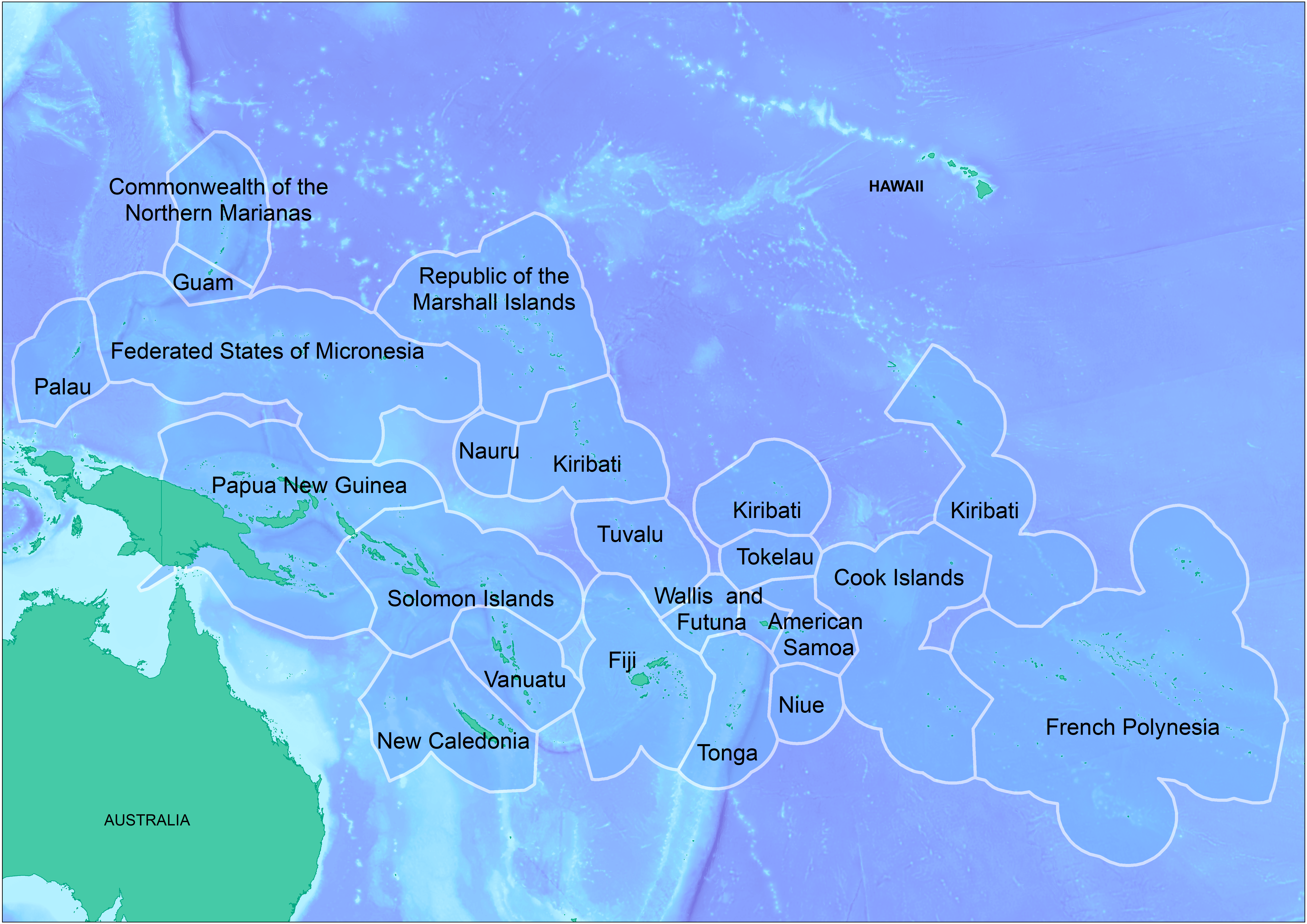
SPREP Guide Map (High Resolution)
The map is high resolution showing SPREP member countries' Exclusive Economic Zone (EEZ) boundaries overlaid on a bathymetric base layer that was developed by the GIS team at SPREP.
SPREP%20Guide%20Map_HighRes_0.png
(7.53 MB)
Additonal Information
| Field | Value |
|---|---|
| mimetype | image/png |
| filesize | 7.53 MB |
| timestamp | Thu, 09/18/2025 - 04:06 |
| Source URL | https://pacific-data.sprep.org/dataset/sprep-maps |