
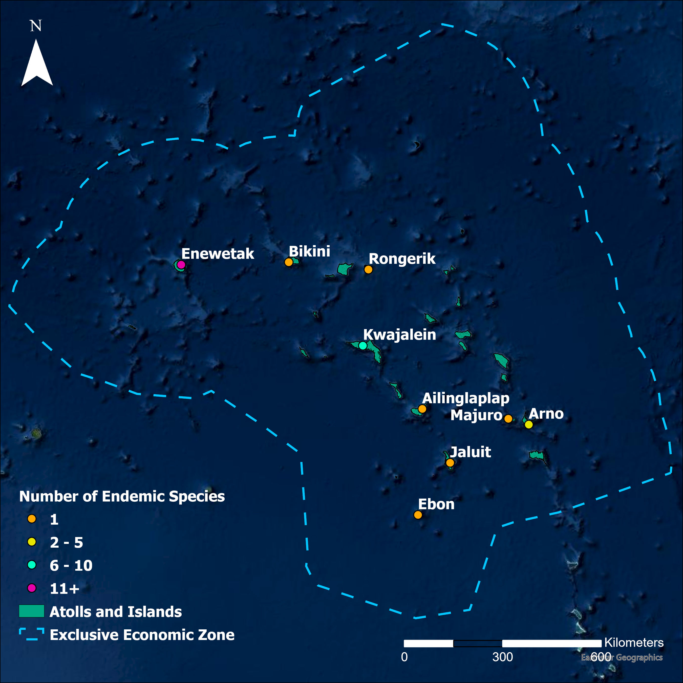
Map of number of endemic species per atoll…
Dataset contains a series of maps that are used in the 2021 Republic of the Marshall Islands State of the Environment Report. Resources within this dataset may be sued for other reporting purposes.
Data and Resource
jpg
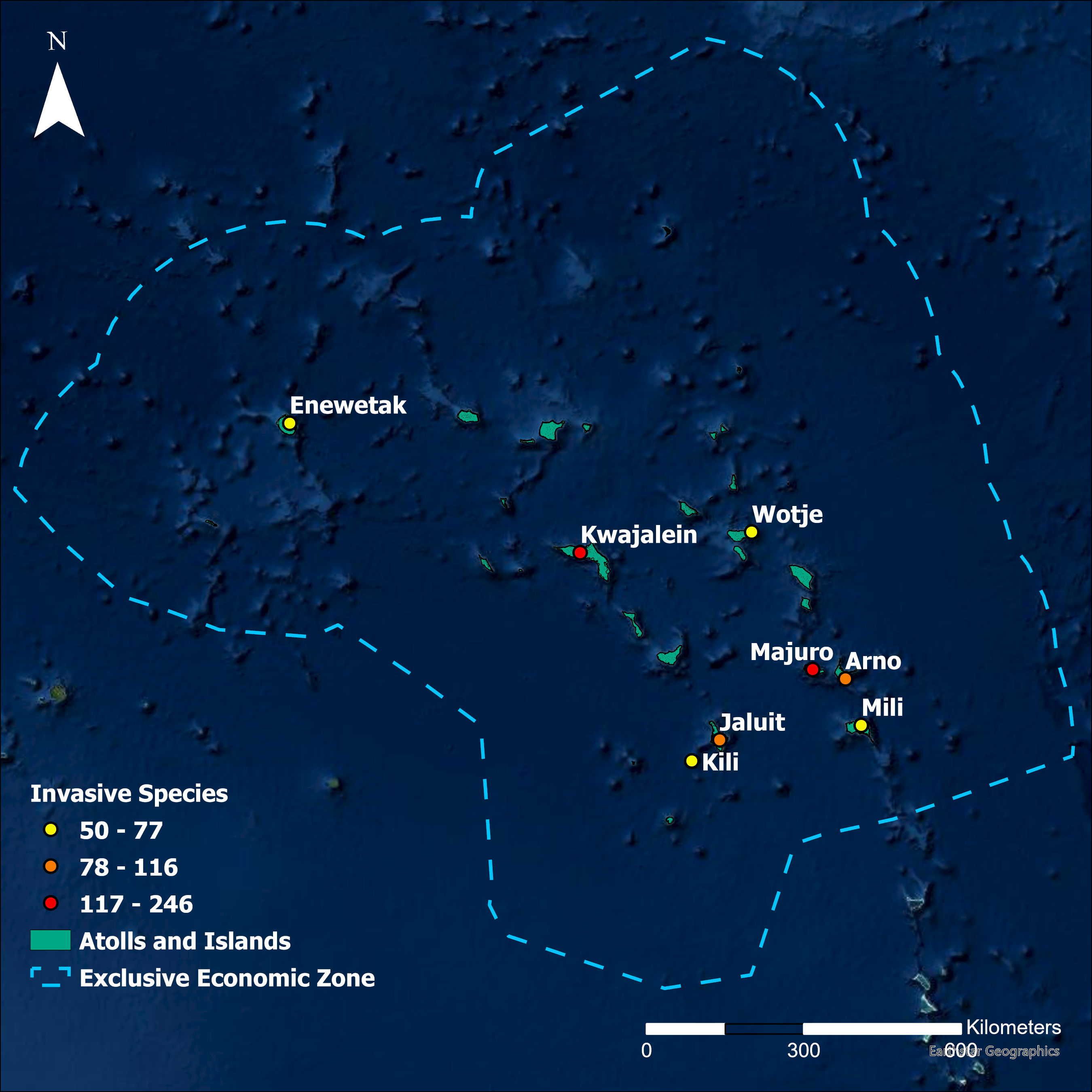
Map of Invasive Species per Atoll in the Marshall Islands
Map of number of invasive species per atoll…
jpg
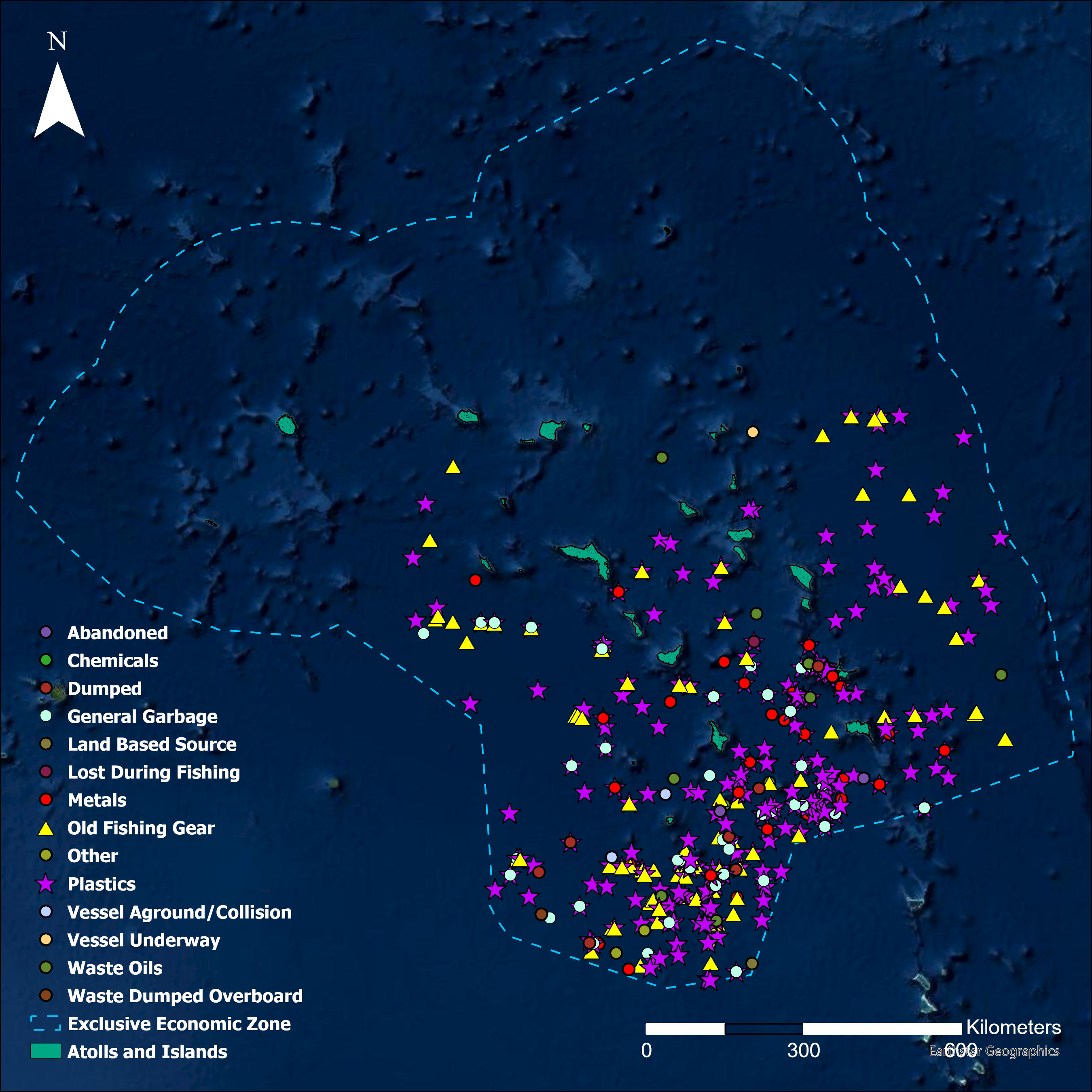
Map of Marine Plastic Pollution Observations for Marshall Islands
Map of observations of marine plastic…
jpg
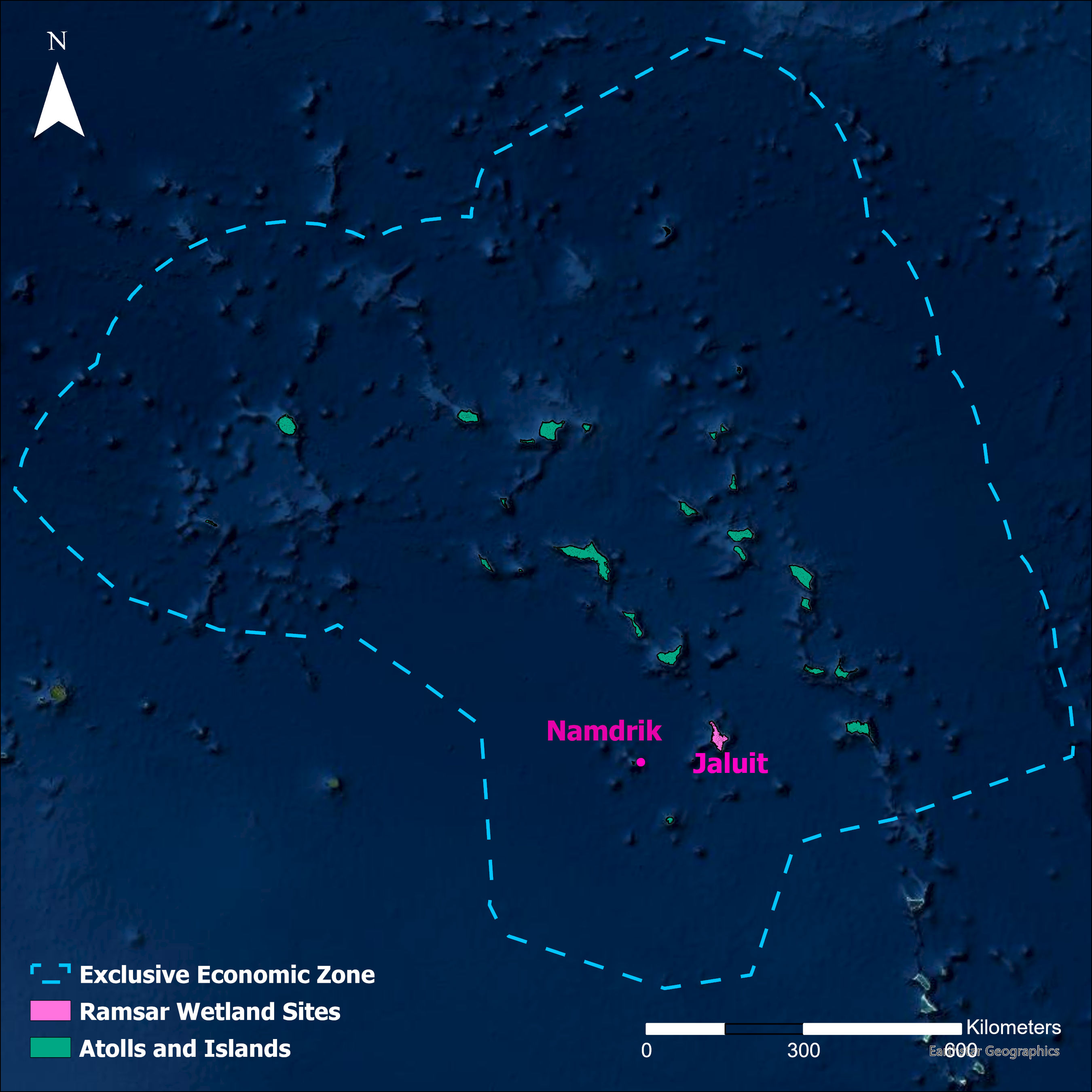
Map of Ramsar Wetlands in the Marshall Islands 2022
Map of Ramsar Wetlands in the Marshall Islands…
| Field | Value |
|---|---|
| Publisher | Secretariat of the Pacific Regional Environment Programme |
| Modified | |
| Release Date | |
| Identifier | 500b98df-a782-4db4-a0b2-11c2d490e42f |
| Spatial / Geographical Coverage Location | Republic of the Marshall Islands |
| Relevant Countries | Republic of the Marshall Islands |
| License |
SPREP Public Licence
![[Open Data]](https://assets.okfn.org/images/ok_buttons/od_80x15_blue.png)
|
| Author | SPREP |
| Contact Name | SPREP |